Part A of the first project in september was to work in groups of four and find interesting landscape maps using books in the uni library. We then made a copy of the map and made a note of:
-The designer, author, Cartographer or Artist of the map.
-The date the map was made
-The book the map was published in
-The author of the book
-The date the book was published
We then pinned up the maps in the studio to discuss them. This was the map i chose:
Cartographer: Geoffrey J Matthews
Date: 1989 (Shows settlements between 1901-1931)
Book: The Historical Atlas of Canada vol 3
Author: William J Carlyle, John C Lehr
Book Published: 1990, Toronto
Project 1: Part B
Part B of the project was to meet at 'The Scoop at More London' on the Thames (For those of you that dont know this area its south of the river where the city hall and tower bridge are and near where the shard is being built).
We then worked in groups to map the route from the scoop near the river to Bermondsey Square. Our map had to be based on one of a selection of words and the group i was in got given the word 'texture'.
Once our data was collected along the route we then were asked to produce an A1 portrait format map based on the data. Here is the map we designed:
 |
| The map was designed by: Davon Bree, Constantinos Tryfonos, Tim Taiwo and Chandy Murugiah. |
Project 1: Part C
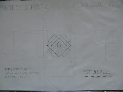
This part of the project involved taking the experience we had in part B and responding to it by developing an installation along the route, again in groups we had been in previously. We were asked to design the installation and produce:
-A scaled drawing of the installation on A1 paper
-A large sketch or collage of the installation
-A model of the installation.
Below is images of the design we came up with:
 |
| Design Development |
 |
| Scaled design at 1:50 |
 |
| Installation Collage |
 |
| Model made using Clay |
Project 1: Part D
Part D was an individual exploration of the route between The Scoop and Bermondsey Square with the intention to extand the route further. We were asked to re-examine the route and consider the next stage of that route based on a word or phrase from a selection we were given. I chose the phrase 'stolen bike'. We were asked to produce two maps at two different scales showing the whole or part of the route on A3 paper or larger, one map being drawn in Adobe Illustrator.
 |
| Design Development |
 |
| Route extended to the nearest police station. Produced in Adobe Illustrator |
 |
| Route extended to Brick Lane. Map drawn in pen and coloured up using pencil. |
Project 1: Part E Landmarks & Nodes
The final part of project 1 was to design a landmark or node point for the destination we had chosen to take our map to in part D of the project. We were asked to produce:
-One A2 sheet of site sketches
-One A2 sheet of precedentand inspiration
-One A2 sheet of proposal sketches
-One A1 sheet showing an axonometric drawing (not yet completed)
My proposal based on the stolen bike phrase was to place landmarks along the route from more london to brick lane that cyclists or walkers could follow. These landmarks would be designed using the shapes and parts from bikes.
 |
| Precedent and inspiration |
 |
| Proposal Sketches |
 |
| Sketches in site locations. Map from Google Earth and edited using Illustrator |
 |
| Destination Landmark in position in Brick Lane |
